30 Second Guide - Surface Water Flood Risk

Henry Crosby
30 Second Guide - Surface Water Flood Risk
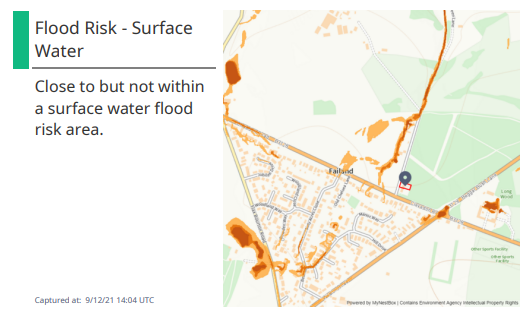
Surface water flooding happens when drains and watercourses are not able to cope with the amount of water run-off from buildings, footpaths and roadways.
This data is outputted from the Risk of Flooding from Surface Water (RoFSW) mapping dataset, previously known as the updated Flood Map for Surface Water (uFMfSW), created by the Environment Agency.
Our maps report the proximity of a site to surface water flood risk areas.